How to Use a Fish Finder on an Idaho Reservoir
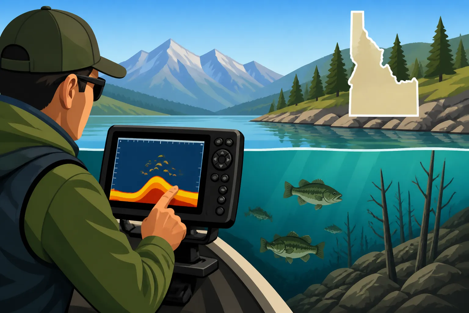
Staring at a seemingly featureless expanse of water on an Idaho reservoir can be incredibly frustrating when you know there are fish down there, but you just can't pinpoint them. It feels like a guessing game, a shot in the dark, and that can really take the joy out of a fishing trip. This guide is all about demystifying your fish finder, transforming that blank screen into a valuable map of the underwater world, and showing you exactly how to use it effectively to find fish on any Idaho reservoir.
Understanding Your Fish Finder's Basics on Idaho Reservoirs
Getting to grips with your fish finder means understanding the technology behind it and how to interpret what it's showing you. It's not just a magic "fish button"—it's a sophisticated tool that, once mastered, can give you an incredible edge on the water, especially in the varied depths and structures of Idaho's reservoirs.
How Sonar Technology Works in Reservoir Environments
At its heart, a fish finder uses sonar technology, which is basically sound waves. Your transducer, that little device usually mounted to the transom of your boat or trolling motor, sends out a pulse of sound, a "ping," into the water. These sound waves travel until they hit something – the bottom, a submerged tree, a school of baitfish, or that trophy smallmouth bass you're after. When they hit an object, they bounce back as an "echo" to the transducer. Your fish finder unit then measures how long it took for that echo to return and uses that information to determine the depth of the object. It also interprets the strength of the echo to give you an idea of what it hit.
In the diverse environments of Idaho reservoirs, this technology becomes even more critical. You'll encounter everything from the relatively flat, muddy bottoms of some agricultural reservoirs to the steep, rocky drop-offs of dammed river canyons. A strong, consistent echo from the bottom usually means a hard bottom, like rock or gravel, while a weaker, more diffused echo suggests a softer bottom, like silt or mud. Understanding this can help you identify prime habitats for different species. For instance, bass often prefer rocky structure, while crappie might gravitate to submerged timber in softer-bottomed coves. The sonar beam spreads out as it goes deeper, like a cone, so the deeper you are, the wider area your fish finder is "seeing" on the bottom. This is a crucial concept to grasp because it means a fish directly under your boat in 10 feet of water might look like a narrow arc, while a fish in 50 feet of water, though still within the cone, could be much further away from the vertical line under your boat and still show up.
Interpreting the Display: Arches, Lines, and Clutter
Once your transducer is sending and receiving signals, your fish finder translates that data into a visual representation on its screen. This is where many anglers get confused. The most iconic symbol is often the "fish arch," which is essentially the curved mark a fish makes as it passes through the sonar cone. A full, strong arch usually indicates a larger fish passing directly through the center of your cone. Smaller, weaker arches or even simple lines can represent smaller fish or fish that are only briefly in the cone's edge.
But it's not just about arches. You'll see lines representing the bottom, which can be thick or thin depending on the hardness of the structure. Irregular bumps or jagged lines rising from the bottom could be submerged trees, rock piles, or old foundations—all excellent fish habitat. Understanding what these marks mean is key to unlocking the reservoir's secrets. Sometimes, you'll see a cloud of smaller, scattered dots or a solid mass of color, which often indicates a bait ball. Where there are bait balls, predator fish are usually not far behind! However, sometimes the screen can get "cluttered" with noise, which could be anything from air bubbles from your prop to electrical interference. Learning to distinguish true fish and structure from this interference takes practice, but once you do, you'll be able to quickly identify productive spots. For example, if you're fishing C.J. Strike Reservoir for Bass and Crappie, knowing what crappie schools look like versus a brush pile is invaluable.
Key Settings to Adjust for Idaho Reservoir Conditions
Think of your fish finder as a camera; it has settings that need to be adjusted for the best picture. The default settings might be okay for a quick scan, but truly maximizing your unit's potential means tweaking a few things.
- Sensitivity (or Gain): This controls how much detail your fish finder picks up. Too low, and you'll miss faint echoes from smaller fish or subtle structure. Too high, and your screen will be full of "noise" or clutter, making it hard to see anything clearly. The trick is to increase it until you start seeing a little noise, then back it off just slightly. This gives you the maximum detail without overwhelming the screen. In deeper water, you might need higher sensitivity, while in shallower, cluttered areas, you'll want to reduce it.
- Frequency: Most modern fish finders offer multiple frequencies, typically 50 kHz (low) and 200 kHz (high). The 50 kHz beam is wider and penetrates deeper, making it great for deep-water searching or general scanning, like when you're exploring the main channels of Fishing Lake Coeur d'Alene for Kokanee and Chinook. The 200 kHz beam is narrower and provides much more detail, excellent for shallow water or pinpointing fish directly under your boat. Some units also have chirp sonar, which uses a range of frequencies to give incredibly clear, detailed images.
- Depth Range: Setting the correct depth range is important for seeing detail. If you're in 20 feet of water but your range is set to 100 feet, the bottom and any fish will appear as a tiny line at the top of the screen. Adjusting it to automatically track the bottom, or manually setting it to just slightly deeper than your current depth, will spread out the image and make it easier to read.
- Scroll Speed: This determines how quickly the sonar history scrolls across your screen. A faster scroll speed provides a more real-time view, which can be helpful when moving quickly. A slower speed compresses the history, making it easier to see how structure or fish patterns develop over a longer stretch.
Experimenting with these settings on the water is the best way to learn. You might find different settings work best for different Idaho reservoirs or even different areas within the same reservoir.
Strategic Placement and Use for Idaho Reservoir Anglers
Having a fish finder is one thing; using it strategically to actually find fish is another. It's about more than just looking at the screen; it's about combining that visual data with your knowledge of fish behavior and the unique characteristics of Idaho's varied reservoir landscapes.
Mounting Your Transducer for Optimal Performance
The transducer is the "eye" of your fish finder, and its proper placement is absolutely critical. A poorly mounted transducer can lead to a fuzzy, unreadable screen, which defeats the entire purpose of having the unit.
- Transom Mount: This is the most common type for smaller boats. It attaches to the back of your boat, submerged just enough to be in clean, undisturbed water. The key here is to avoid turbulence from the motor or hull, which can create air bubbles that interfere with the sonar signal. You might need to experiment with the angle and depth slightly to find the "sweet spot" where you get a clear reading at both low and high speeds.
- Trolling Motor Mount: For many bass and walleye anglers, mounting the transducer directly to the trolling motor is ideal. This allows the transducer to always point in the direction the trolling motor is facing, giving you a real-time view of what's ahead, which is fantastic for navigating submerged structure or following contour lines. This is particularly useful when you're trying to explore the intricate shorelines of Fishing Lucky Peak Reservoir Near Boise. You can find various clamps and brackets for this purpose on Amazon, offering different degrees of flexibility.
- In-Hull Mount: Some larger fiberglass boats use in-hull transducers, which are epoxied directly to the inside of the hull. These shoot the sonar signal right through the fiberglass. While they offer protection from damage and a clean aesthetic, they can sometimes lose a bit of sensitivity compared to direct water contact.
- Portable Mounts: For kayak anglers or those who switch boats frequently, portable transducers with suction cups or clamp-on arms are available. These are convenient but require careful placement each time to ensure clear readings.
No matter the mount, the goal is always to get the transducer into clean, non-aerated water. A clear, crisp signal is your best friend when trying to locate fish.
Scanning for Structure: Where Fish Hide in Reservoirs
Fish are creatures of habit and often relate to structure for cover, ambush points, or temperature regulation. Your fish finder is the ultimate tool for discovering these hidden fish magnets in Idaho's reservoirs.
- Ledges and Drop-Offs: These are natural highways for fish. As you move your boat along a ledge, watch your screen for changes in depth and any marks indicating fish relating to that vertical structure. Fish often suspend just off the edge or hug the bottom along the break.
- Submerged Timber and Brush Piles: These show up as irregular, often jagged masses rising from the bottom. They are absolute magnets for crappie, bass, and sometimes even perch. The trick is to identify them and then get your lure into the tangled mess without getting permanently snagged.
- Old Roadbeds and Creek Channels: Many reservoirs were created by flooding valleys, leaving behind remnants of old roads, bridges, and natural creek channels. These often appear as distinct changes in bottom contour or sometimes even as faint outlines of old structures. Fish use these historical features as travel routes and feeding grounds. For example, if you're fishing Anderson Ranch Reservoir for kokanee, finding old creek channels might lead you to deeper schools.
- Humps and Points: Underwater humps or points extending from the shore provide excellent ambush points and can concentrate baitfish. Your fish finder will show the bottom rising significantly and then dropping off, indicating a potential hotspot.
By slowly scanning these types of areas, you can build a mental (or even physical with GPS) map of the reservoir's underwater landscape, revealing secrets that shore anglers or those without electronics simply can't access. Pay attention to how the fish relate to different types of structure based on the species you're targeting and the time of year.
Locating Bait Balls and Predator Fish
One of the most exciting things a fish finder can show you is a big cloud of baitfish. Where there's bait, there are almost certainly bigger fish feeding on them.
- Identifying Bait Balls: Baitfish, like kokanee or minnows, usually show up as dense clouds of small, scattered dots or a large, irregular mass on your screen. Sometimes, these clouds will be tightly packed; other times, they might be more dispersed. Their appearance can vary with the species and how they are behaving.
- Distinguishing Predator Fish Marks: Look for larger, distinct arches or strong, solid lines either right in or directly underneath these bait balls. These are often the predator fish – the kokanee, trout, bass, or even chinook salmon that are actively feeding. If you see arches scattered above a bait ball, they might be picking off stragglers. If they're within or below the ball, they're likely pushing them up or gorging themselves. This is particularly relevant when you're trying to figure out What Depth Kokanee Hold at in Summer on Idaho Lakes or hunting down trout.
- Understanding Behavior: Sometimes you'll see large arches that are separate from any bait, indicating solitary, possibly larger, fish. Other times, you'll see groups of fish marks moving together, perhaps a school of crappie relating to a specific piece of timber, or a pod of bass cruising a drop-off. Learning to interpret these patterns helps you choose the right fishing technique, whether it's jigging vertically or casting to a specific spot.
The synergy between finding structure and finding bait is powerful. A good strategy is to find promising structure, then scan for bait around it. If you find both, you've likely hit a goldmine. Many anglers rely on their fish finders to pinpoint baitfish schools when How to Troll for Kokanee on Lake Coeur d'Alene.
Advanced Tips for Maximizing Your Fish Finder's Potential
Once you've mastered the basics, there's a whole new level of detail and functionality your fish finder offers. Modern units are packed with features that can turn you into an underwater cartographer and a master fish locator.
Using GPS and Mapping Features on Idaho Reservoirs
Today's fish finders are often integrated with powerful GPS and mapping capabilities that go far beyond just telling you where you are. These features are indispensable for truly dissecting an Idaho reservoir.
- Marking Waypoints: This is perhaps the simplest yet most effective use. When your fish finder lights up with fish or you discover a fantastic piece of submerged timber, mark it. A waypoint saves that exact location, allowing you to return to it later. Over time, you'll build a personal library of hotspots across your favorite reservoirs. This is incredibly helpful when you discover a promising area and need to circle back to it after making a pass, or if you want to remember that specific spot where you saw Idaho Trout Limits by Water of a certain size.
- Creating Custom Maps: Many units allow you to contribute sonar data to create or enhance detailed contour maps of the lake bottom. As you motor around, your fish finder continuously records depth data, and this information can be used to generate highly accurate, personalized maps. These user-generated maps often reveal small humps, channels, or breaks that might not appear on standard navigation charts, giving you a competitive edge. This is especially useful for areas where commercial maps are less detailed, or for new reservoirs you're exploring.
- Understanding Contours: Contour lines on your map represent changes in depth. Learning to "read" these contours is like reading a topographic map on land. Tight contour lines indicate steep drop-offs or banks, while widely spaced lines show gently sloping areas. Fish often relate to these contour changes, using them as travel corridors or staging areas. By following contour lines with your boat, you can efficiently cover prime fish-holding depths and structures. For instance, when trying to pinpoint certain species that have specific Idaho Kokanee Bag Limits you want to meet, knowing exactly how the contours run can make all the difference.
Investing in a good mapping chip or actively participating in mapping programs can significantly enhance your ability to find fish consistently. You can often find compatible mapping cards for your specific fish finder model on Amazon.
Side Imaging and Down Imaging for Enhanced Views
Beyond traditional 2D sonar, many mid-range and high-end fish finders now include advanced imaging technologies that offer picture-like views of the underwater world.
- Down Imaging (or DownVu/ClearVu): This technology sends out a very thin, high-frequency beam directly beneath your boat, creating a narrow, fan-shaped image. The result is a much clearer, more detailed, and almost photographic view of what's directly below. You can distinguish individual tree branches, see rocks with incredible clarity, and often differentiate fish from structure much more easily than with traditional 2D sonar. It's excellent for identifying exactly what kind of cover fish are holding in, or for spotting individual fish relating tightly to the bottom. If you're wondering what Best Lures for Idaho Kokanee Fishing to drop down to a school you just found, down imaging can confirm if they are tightly packed or more spread out, influencing your presentation.
- Side Imaging (or SideVu): This is perhaps the most revolutionary advancement for many anglers. Side imaging sends out thin, high-frequency beams to the sides of your boat, covering a wide swath of water on either side (up to several hundred feet on some units). This allows you to scan vast areas quickly and "see" structure, cover, and fish that are far off to the port or starboard, not just directly beneath your boat. You can spot submerged ledges, rock piles, brush, and even individual fish well before you drive over them. This is incredibly useful for covering large areas of a reservoir efficiently, like the broader expanses of Fishing Lake Pend Oreille for Rainbow Trout, and for staying a safe distance from spooking fish. When you spot something interesting off to the side, you can then mark a waypoint and slowly approach it, knowing exactly where the target is.
Learning to interpret side and down imaging takes a bit of practice, as the displays look different from traditional 2D sonar. However, the level of detail they provide is unmatched, truly giving you an underwater X-ray vision that can transform your fishing success.
Combining Fish Finder Data with Environmental Cues
A fish finder is a powerful tool, but it's not a standalone magic bullet. The most successful anglers combine the information from their electronics with a broader understanding of the environment and fish behavior.
- Water Temperature: Many fish finders include a temperature gauge in their transducer. Water temperature is one of the most critical factors influencing fish activity. Different species have preferred temperature ranges, and understanding thermal layers (thermoclines) can help you pinpoint where fish are most likely to be active. For instance, in summer, many fish will congregate just above or within the cooler water of the thermocline.
- Currents and Wind: Even in reservoirs, currents can exist, especially near dam outflows or river inlets. Fish often use subtle currents to orient themselves and ambush prey. Wind can also create surface currents that stack baitfish, and consequently, predator fish, on certain banks or points. While your fish finder won't directly show current, it can show you how fish are positioned relative to structure in areas where current might be a factor.
- Time of Day and Seasonal Patterns: Fish behavior changes dramatically with the time of day and season. Early morning or late evening often brings fish shallower to feed, while midday heat might send them deeper or into heavy cover. Knowing When Idaho's Steelhead Season Runs Through the Winter or when trout are most active, for example, helps you interpret your fish finder data more effectively. If you're marking fish deep in summer, it makes sense; if you're marking them deep in spring, they might be suspending due to Idaho Fishing Techniques for Muddy Spring Water.
- Matching Depth to Forage: If you're marking schools of kokanee at a certain depth (you can even use a Trolling Depth Chart for Idaho Kokanee by Month to cross-reference), and then you start marking larger fish at that same depth, you can bet those bigger fish are feeding on the kokanee. This knowledge then informs your lure choice, depth presentation, and retrieval techniques.
By looking at the complete picture—what your fish finder is showing, what the water conditions are, and what the time of year dictates—you'll develop an intuition that dramatically increases your chances of success on any Idaho reservoir. It takes practice, but the rewards are well worth the effort.
Here's a quick reference table for interpreting common fish finder displays:
| Display Pattern | Common Interpretation | Likely Scenario |
|---|---|---|
| Solid, Strong Arches | Large fish, or fish passing directly through the center of the sonar cone. | A sizable trout or bass is directly beneath your boat, likely actively swimming. |
| Small, Broken Lines/Arches | Smaller fish, or fish passing through the edge of the sonar cone. | A school of perch or crappie, or a single smaller fish quickly passing by. |
| Dense Cloud of Dots/Color | Bait ball (school of small baitfish like kokanee or minnows). | Thousands of small baitfish grouped together for protection; often indicates larger predator fish are nearby, like when How to Find Kokanee on a Fish Finder. |
| Jagged Lines/Irregular Bumps | Submerged timber, brush, rock piles, or other complex cover. | Excellent cover for bass, crappie, and other species. Fish may be holding tight to the structure; look for arches within or just above these marks. |
| Distinct Line, Changes Depth | Bottom contour, ledges, or drop-offs. | A structural break that fish will use for travel, feeding, or ambush. Look for fish marks along these lines. |
| Scattered Marks Above Bottom | Suspended fish, often feeding or schooling in the water column. | Fish that aren't hugging the bottom, perhaps chasing bait or holding in a thermocline. Common for kokanee, trout, or walleye. This is useful if you are targeting Idaho Kokanee Bag Limits as they often suspend. |
| Faint, Random Speckles | Clutter or noise (debris, air bubbles, electrical interference). | Happens with incorrect sensitivity settings, or when passing over dense plankton blooms. Reduce sensitivity slightly to clear the screen. |
Disclaimer
This article is for general informational purposes only and does not constitute professional advice. Laws, prices and regulations vary by location and change over time. Consult a qualified professional for guidance on your specific situation.