How to Scout an Idaho River Before Your First Trip
Heading out to a new stretch of Idaho river can be both exhilarating and a little intimidating. You're filled with anticipation, but also that nagging worry: "Am I going to spend all day casting into dead water?" It's a common frustration, especially with Idaho's vast and diverse waterways. This guide is all about equipping you with the knowledge and actionable steps to effectively scout an Idaho river before your first cast, maximizing your chances of finding fish and enjoying a truly rewarding day on the water.
Why Scouting is Crucial for Idaho River Fishing Success
Idaho's rivers aren't your average backyard creek. They're dynamic, often remote, and teeming with various species that behave differently depending on the season, water conditions, and even the time of day. Just showing up and hoping for the best can lead to a lot of wasted time and frustration, especially if you're targeting specific fish like elusive steelhead or picky trout. A little upfront reconnaissance can make all the difference between a memorable day of bending a rod and a disheartening blank.
Understanding Idaho's Dynamic River Systems
Idaho is a land of incredible hydrological diversity, from the broad, powerful flow of the Snake River to the intimate, technical spring creeks like Silver Creek, and the vast, untamed stretches of the Salmon River. Each river, and even different sections of the same river, presents its own set of challenges and opportunities. Water levels can fluctuate wildly with snowmelt and rain, clarity can change with runoff or local disturbances, and temperature swings directly impact fish activity. Knowing what you're getting into before you arrive can help you pack the right gear and set realistic expectations.
Imagine planning a trip to the Clearwater River for steelhead. Without scouting, you might show up during peak runoff when the river is a chocolate milk torrent, unfishable for conventional methods. Or you might go to a stretch known for power-boating when you prefer a quiet, wade-fishing experience. By understanding the specific river system, its typical flows, seasonal patterns, and unique characteristics, you can choose your timing and location much more wisely. It's about respecting the river and putting yourself in the best possible position to succeed.
Avoiding Common First-Timer Pitfalls
Let's be honest: no one likes to drive hours to a new spot only to find out it's private property, inaccessible, or completely blown out. These are common pitfalls for anglers who skip the scouting phase. You might spend valuable fishing time searching for public access, struggling through dense brush, or worse, accidentally trespassing. Without proper scouting, you might also overlook prime holding water, focusing instead on easily accessible but less productive areas.
Another pitfall is showing up with the wrong gear. If you haven't scouted the river, you might not know if it's a wide-open casting environment for fly fishing or if dense bank vegetation demands shorter rods and accurate roll casts. Are you going to be wading across strong currents, necessitating a sturdy wading staff and appropriate footwear? Or will you be fishing from a boat? Proper scouting helps you anticipate these practicalities, ensuring you bring what you need and leave what you don't. It saves you money, time, and a whole lot of headache.
Pre-Trip Digital Scouting: Your Armchair Reconnaissance
Before you even load up the truck, your couch or desk can become mission control for some seriously effective scouting. The internet provides a wealth of information that can paint a detailed picture of your target river, helping you narrow down your focus and plan your attack. This digital reconnaissance is your first and often most critical step.
Harnessing Online Maps and Satellite Imagery
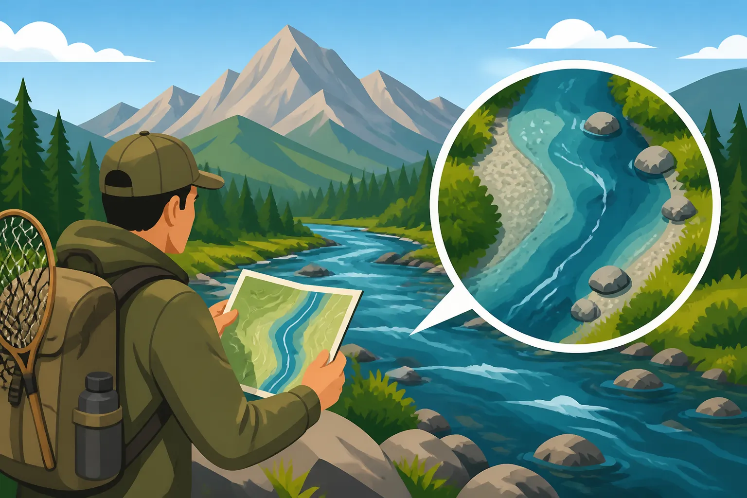
Think of online mapping tools like Google Maps or even specialized fishing apps as your virtual helicopter tour of the river. You can zoom in and out, identifying potential access points, parking areas, and critical water features. Look for bends in the river, confluences with tributaries, islands, and significant changes in topography that might indicate deeper pools or faster riffles. Pay attention to anything that looks like structure—rock gardens, fallen trees, or undercut banks—these are all potential fish holding lies.
Satellite imagery can reveal things a standard map can't, like distinct current breaks, deeper channels (often appearing darker), and areas of bank erosion that could create prime habitat. I always look for bridges and roads, as these often coincide with public access points. You can also trace the path of trails along the river, giving you an idea of how far you might need to hike to reach less pressured water. Plotting these points on a personal map, whether digital or printed, is an essential step. Even looking at street view if available can give you a better idea of the terrain and bankside vegetation.
Leveraging Flow Data and Weather Forecasts
Idaho's rivers are incredibly sensitive to flow rates and weather. A river that fished beautifully at 1,000 cubic feet per second (cfs) might be a raging torrent at 5,000 cfs, making it unsafe or unfishable. Websites like the USGS Water Data portal provide real-time and historical flow data for many major rivers. By checking these graphs, you can see if the river is rising, falling, or stable, and compare current conditions to historical averages for the time of year. This data is invaluable for understanding the character of the water you'll encounter. For instance, if you're planning a trip to the Henry's Fork, you'd want to check how "Henry's Fork's 70 Miles of Fishable Water Explained" relates to current flow rates for optimal fishing.
Pair this with a detailed weather forecast. Heavy rain upstream can quickly blow out a river, turning clear water muddy. A sudden warm spell can trigger snowmelt, increasing flows and dropping water temperatures. Conversely, a sustained cold snap might make fish sluggish or even create ice-fishing opportunities in stiller waters. Understanding the forecast helps you prepare for the elements, choose appropriate clothing (like waders for cold water), and even decide if it's worth delaying your trip a day or two for better conditions. It also helps you anticipate how the water might change during your trip.
Diving into Angler Forums and Local Reports
Sometimes, the best information comes from other anglers. Online fishing forums, local social media groups, and even fishing reports from tackle shops can provide anecdotal evidence and current conditions that aren't available through maps or flow data alone. People often share recent successes, what flies or lures are working, and specific challenges they've encountered. Be discerning with this information, as not everything online is accurate, but it can offer valuable insights into specific stretches of river or seasonal patterns.
For example, if you're targeting specific species, searching for discussions on "How to Fish for Steelhead in Idaho" or "How to Fish for Kokanee in Idaho" might reveal recent tips about preferred gear or fishing techniques for current conditions. Local fly shops in towns like Driggs, Riggins, or Lewiston often have up-to-date fishing reports that can be gold mines. A quick phone call or a check of their website before you head out can save you hours of trial and error. Just remember to be respectful of local knowledge and don't expect people to give away their secret spots easily!
On-the-Ground Scouting: When You Arrive
Once you've done your digital homework and arrived at the river, the real scouting begins. This isn't just about walking the bank; it's about actively observing, listening, and "reading the water" to pinpoint where fish are likely to be holding and feeding. This is where your virtual maps come to life, and your assumptions get tested against reality.
Identifying Productive Water Features
As you walk the riverbank, or even float downstream, your eyes should be scanning for prime fish habitat. Fish need three things: food, cover, and comfortable water temperature/flow. Productive water features are places where these elements combine.
- Riffles and Runs: These are stretches of faster, shallower water where the surface is broken. They churn up oxygen and dislodge insects, providing a conveyor belt of food. Fish will often hold in the transition zones where a riffle slows into a deeper run, or behind larger rocks that break the current.
- Pools: Deeper, slower-moving sections of the river. These offer refuge from strong currents and predators, especially during bright sunlight or high flows. Look for varying depths, structure on the bottom (rocks, logs), and shaded areas.
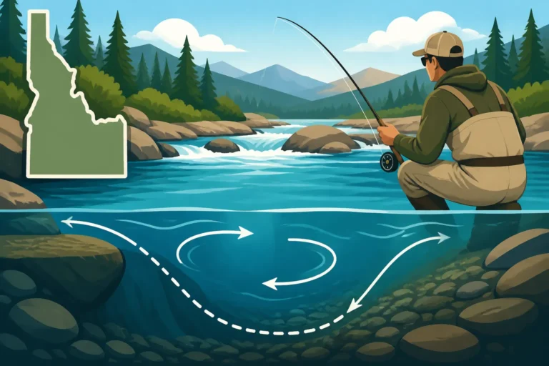
- Seams and Current Breaks: This is where fast water meets slow water, creating distinct lines on the surface. Fish often sit in the slower water, waiting for food to drift by in the faster current without expending much energy. These are critical ambush points.
- Structure: Anything that provides cover or alters the current. This includes fallen trees (logjams), large boulders, undercut banks, bridge pilings, and even dense aquatic vegetation. Fish use these spots to hide from predators, escape strong currents, and ambush prey.
- Confluences: Where two rivers or a stream and a river meet. These areas often bring in new food sources, different water temperatures, and varied flows, concentrating fish. The mixing of water creates interesting current dynamics that can be very productive. Learning to identify these features is key to "Reading Water on Idaho's Rivers".
Assessing Access Points and Safety
Scouting on the ground isn't just about finding fish; it's about ensuring a safe and legal fishing experience. What looked like easy access on a map might be a treacherous scramble down a muddy bank in person. Take note of official access points, parking availability, and any signage indicating private property. Remember, even if you can walk along the riverbed, the banks above the high-water mark might be private. Always respect private property signs.
Safety is paramount, especially on Idaho's powerful rivers. Assess the wading conditions: is the bottom rocky and slippery, requiring cleats or a wading staff? Are there deep drop-offs close to shore? How strong is the current, and is it safe to cross if you need to? Check for any wildlife trails or signs of animals. If you're planning a trip to a remote area, consider bringing a personal locator beacon or satellite communication device, especially if cellular service is spotty. Always let someone know where you're going and when you expect to return. This is especially true when venturing into areas like "Idaho's Most Remote Fishing Water".
Observing Local Insect Activity and Fish Behavior
Once you're by the water, take a moment to simply observe. What insects are flying around? Are there any bugs hatching or emerging from the water? Look for adult insects fluttering near the surface, or nymphs clinging to rocks. This tells you what the fish might be feeding on. A good pair of polarized sunglasses, available from retailers like Amazon, can help you peer beneath the surface to spot submerged structure or even cruising fish.
Watch the water's surface for rises or boils, indicating actively feeding fish. Even if you don't see fish, look for subtle signs like baitfish scattering or birds diving, which can point to larger predatory fish like trout or bass. Observe how the current carries debris – this gives you a real-world understanding of the drift your fly or lure will take. If you see fish consistently rising in a particular seam, you've just found a key target area. Pay attention to how the fish are rising, too; a gentle sip suggests dry flies, while an aggressive splash might mean emergers or even small baitfish.
Gear and Tools for Effective Scouting
Effective scouting isn't just about your eyes and ears; it's also about having the right tools to gather and interpret information. Just as a carpenter needs specific tools for a job, an angler needs a few key items to make their scouting mission productive. Don't underestimate the value of carrying a dedicated scouting kit.
Essential Mapping and Navigation Tools
Even with a fully charged phone, a backup physical map is a lifesaver, especially in areas with no cell service. A good topographic map, showing elevation changes and detailed water features, can confirm what you see on satellite imagery and provide crucial context. Many outdoor stores carry waterproof regional maps, or you can print out sections from online sources. A waterproof case for your phone, which you can easily find on Amazon, is also non-negotiable for protecting your digital maps and flow data.
Beyond maps, a simple compass can be invaluable for orientation, especially if you venture off-trail. While many phones have built-in GPS, a dedicated handheld GPS unit or a sturdy compass ensures you always know where you are and how to get back, even if your phone battery dies. Mark interesting spots you find during your ground scouting, whether it's a promising pool, an easy access point, or a tricky crossing. This allows you to easily revisit these locations on your actual fishing trip.
Optics and Observation Equipment
You can't catch what you can't see, and often, the fish are holding in subtle spots or just out of sight. High-quality optics are a scout's best friend.
- Polarized Sunglasses: These are absolutely crucial. They cut glare off the water's surface, allowing you to see into the water, spot submerged rocks, logs, and even fish. Different lens colors are better for different light conditions, but a good all-around amber or copper lens is usually a solid choice for Idaho's diverse waters. You can find excellent options online, including from major retailers like Amazon.
- Binoculars: A compact pair of binoculars (8x or 10x magnification is usually plenty) can help you survey distant stretches of river without having to hike them. You can spot rising fish, identify potential holding lies, or even see if other anglers are already occupying a prime spot far upstream or downstream. They also allow you to observe insect hatches from a distance, giving you a better understanding of what's going on.
- Camera: Your phone camera is perfectly adequate. Use it not just for photos of beautiful scenery, but to document features of the river. Take pictures of access points, tricky wading areas, specific rock formations, or promising pools. A visual reference can be incredibly helpful when you're back home planning your next move, or trying to explain a spot to a fishing buddy.
By combining thorough digital reconnaissance with keen on-the-ground observation and the right tools, you'll transform your first trip to an Idaho river from a guessing game into a well-informed adventure. Taking the time to scout shows respect for the resource and dramatically increases your chances of a successful and enjoyable day. Now go get those fish!
Disclaimer
This article is for general informational purposes only and does not constitute professional advice. Laws, prices and regulations vary by location and change over time. Consult a qualified professional for guidance on your specific situation.